Preface- I began writing this blog shortly after our trip. Since I've gone back to college, time isn't something I've had an excess of. Here I am more than a year later finishing it up and we've been to three National Parks since!
My Dad passed away in January of 2011 and I am incredibly thankful that we got to share this experience with him. I inherited my love of nature from my dad. He knew something about everything and he was happy to share his knowledge. I have the urge to go back and rewrite what I've already done in this blog entry. I could write about how Dad, Rachel and I spent lunch overlooking Artist's Palette while trying to identify a sprig of desert holly. Or how every night Dad would announce "there's Venus!" shortly after sunset. But when I started this blog the memories were fresh and I will leave them as I originally wrote them. After all, this blog is supposed to be about the parks. I will never forget the moments I shared with Dad. This blog is dedicated to Ray Jenkins, my dad, a great guy. I love you Dad.

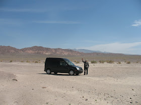
On April fools day 2010, Rachel and I woke up early in a hotel just outside of Joshua Tree National Park. We had just spent 4 days camping in Joshua Tree and after our breakfast in bed (PB&Js) we got in the car and sped off to Death Valley National Park. The plan was to spend 6 nights in Death Valley. When Rachel and I plan our vacations we tend to get greedy. My Dad (Rachel's Father in heart) was driving his brand new Ford Transit across the country to meet us there. It was a five and a half hour drive for us, but it didn't feel very long driving through the deserts of California. The scenery was new to us and kept us entertained. We stopped for a gyro in Baker, CA. It was the last outpost of civilization we would see for a week. Unless you count the multiple resorts and the golf course in Death Valley itself!
Once we entered Death Valley Park we knew we were in another world. After driving over the mountains on the edge of the park we saw the valley itself. Well technically it's not a valley at all since it wasn't formed by water. It's actually called a graben, which is the name for a deep depression created by parallel faults. Once we were over the mountainous rim we started descending into the infamous inferno. Contrary to Death Valley's reputation, the weather on this early April afternoon was quite pleasant. The view we received on our steady decline was out of this world. The whole valley floor was laid out in front of us. At 20 miles across we could see the snow capped mountains on the other side of the valley, but at 190 miles long the salt and sand seemed to stretch on to infinity to the north and south of us. Upon entering the park we had picked up a basic map of Death Valley. We had reserved our campsite online and had no idea what we were in for. This simple map showed our campground on the floor of the valley. I could barely contain my excitement; we were going to camp at the base of Death Valley!
Our campsite was right next to a golf resort. A giant grove of fan palms grows unnaturally out of the barren soil. It was a strange site to see all that green in the midst of one of the driest places on earth. We were glad it was there though because we had heard there was a pool and showers that the resort allowed campers like us to use for a small price. Just past the resort was the Furnace Creek Welcome Center. We stopped in to pay our entrance fee and buy a good map of the park and a trail guide. The place was a zoo; people everywhere. I looked all over, but couldn't find a detailed map of the park. When I asked the book store clerk he told me they were sold out and we could possibly buy one at the Scotty's Castle Welcome Center 50 miles to the north. This is when I started to grasp how enormous the park really is. Scotty's Castle was a little over halfway between us and the parks northern boundary and the southern boundary was almost as far from us as the northern one, Death Valley is 130 mile long north to south! The books store was running low on trail guides too. I couldn't find a small one so I bought Hiking Death Valley: A Guide to it's Natural Wonders and Mining Past. by Michel Digonnet. Rachel and I aren't very interested in the human history at national parks, so I didn't know if we really would dig on it. Sorry for that awful joke, I couldn't help myself. Anyway, the book is a beast. It's over 500 pages; not exactly what you want to carry around on a desert hike. It did the job though. It is a very thorough guide book and I was glad I bought it. After the welcome center we drove the .1 miles to Furnace Creek Campground. While waiting behind another car to get our camping sticker Rachel said, "Is that your Dad's car?" We were supposed to meet Dad sometime that day, but it seemed hard to believe Dad could have driven from Wisconsin so quickly. When it was our turn to get our sticker the Ranger told us someone had already made it too our campsite. It was Dad's truck.

Dad had arrived not long before us. We caught up while Rachel and I got the car unpacked and reorganized, which was no easy task after breaking camp at Joshua Tree National Park in a frenzy. I thought it was great that the first time I went to California I got to see both of my parents (I had seen my mom earlier on the same trip; check out our Joshua Tree blog if you're interested). Dad made a bed that fit right in the back of his truck, so his camping was very compact and efficient. After we got settled in we took a short walk over to the resort to see what sort of amenities we could take advantage of and check out the pool. To get there we walked though a small outdoor pavilion with a wooden stage. We also walked though the man made grove of fan palms we had seen from the road.

Dad noticed there was something yellow all over the toes of our shoes. There were small wildflowers all over the place and they were pollinating our feet.
Once we entered Death Valley Park we knew we were in another world. After driving over the mountains on the edge of the park we saw the valley itself. Well technically it's not a valley at all since it wasn't formed by water. It's actually called a graben, which is the name for a deep depression created by parallel faults. Once we were over the mountainous rim we started descending into the infamous inferno. Contrary to Death Valley's reputation, the weather on this early April afternoon was quite pleasant. The view we received on our steady decline was out of this world. The whole valley floor was laid out in front of us. At 20 miles across we could see the snow capped mountains on the other side of the valley, but at 190 miles long the salt and sand seemed to stretch on to infinity to the north and south of us. Upon entering the park we had picked up a basic map of Death Valley. We had reserved our campsite online and had no idea what we were in for. This simple map showed our campground on the floor of the valley. I could barely contain my excitement; we were going to camp at the base of Death Valley!
Our campsite was right next to a golf resort. A giant grove of fan palms grows unnaturally out of the barren soil. It was a strange site to see all that green in the midst of one of the driest places on earth. We were glad it was there though because we had heard there was a pool and showers that the resort allowed campers like us to use for a small price. Just past the resort was the Furnace Creek Welcome Center. We stopped in to pay our entrance fee and buy a good map of the park and a trail guide. The place was a zoo; people everywhere. I looked all over, but couldn't find a detailed map of the park. When I asked the book store clerk he told me they were sold out and we could possibly buy one at the Scotty's Castle Welcome Center 50 miles to the north. This is when I started to grasp how enormous the park really is. Scotty's Castle was a little over halfway between us and the parks northern boundary and the southern boundary was almost as far from us as the northern one, Death Valley is 130 mile long north to south! The books store was running low on trail guides too. I couldn't find a small one so I bought Hiking Death Valley: A Guide to it's Natural Wonders and Mining Past. by Michel Digonnet. Rachel and I aren't very interested in the human history at national parks, so I didn't know if we really would dig on it. Sorry for that awful joke, I couldn't help myself. Anyway, the book is a beast. It's over 500 pages; not exactly what you want to carry around on a desert hike. It did the job though. It is a very thorough guide book and I was glad I bought it. After the welcome center we drove the .1 miles to Furnace Creek Campground. While waiting behind another car to get our camping sticker Rachel said, "Is that your Dad's car?" We were supposed to meet Dad sometime that day, but it seemed hard to believe Dad could have driven from Wisconsin so quickly. When it was our turn to get our sticker the Ranger told us someone had already made it too our campsite. It was Dad's truck.

Dad had arrived not long before us. We caught up while Rachel and I got the car unpacked and reorganized, which was no easy task after breaking camp at Joshua Tree National Park in a frenzy. I thought it was great that the first time I went to California I got to see both of my parents (I had seen my mom earlier on the same trip; check out our Joshua Tree blog if you're interested). Dad made a bed that fit right in the back of his truck, so his camping was very compact and efficient. After we got settled in we took a short walk over to the resort to see what sort of amenities we could take advantage of and check out the pool. To get there we walked though a small outdoor pavilion with a wooden stage. We also walked though the man made grove of fan palms we had seen from the road.


Dad noticed there was something yellow all over the toes of our shoes. There were small wildflowers all over the place and they were pollinating our feet.
Just beyond the palm grove was the resort itself. They did have a pool like we'd heard and they had tennis courts, restaurants, a general store, a Borax Museum, and ice machines! Our first stop was the general store. The store had everything we could possibly need and I found a National Geographic Trails Illustrated map of the park. We wouldn't have to drive all the way to Scotty's Castle the next day after all. After the store we checked out the pool. It looked real nice and we knew after a couple of days in one of the hottest placed on earth we were going to need it. After our self guided tour of the resort we headed back to our campsite to have dinner and make a fire.
The next morning we ate banana pancakes. They were delicious, but the bananas made them take forever to cook and we only had one pan. We took turns eating one pancake at a time. Breakfast took about an hour and a half.

There was a Great-tailed Grackle and a Eurasian Collared Dove at the campsite next to ours. They were watching and waiting for us to finish up our meal in the hopes of getting some scraps.
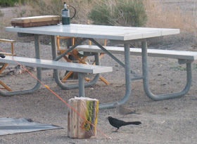
In the air we saw a different sort of bird. A stealth bomber and another plane were overhead either training or doing a photo shoot.

Having that much time in between pancakes afforded me many opportunities to look over my new map and trail guide to figure out just what we were going to do in this incredibly vast park. I thought heading south for our first excursion seem like a fine idea so that's what we did. As soon as our lengthy breakfast was finished we piled in Dad's truck and drove to Badwater Basin, the lowest spot in the US.
Badwater has a small spring fed pool of salty water next to an expansive salt plain. The salt plain is a crust of salt which crystallizes to form hexagonal shapes. A huge path of crushed salt crystals leads from the road to the middle of the salt plain. Somewhere in this giant salt slick is the lowest spot in the U.S. at 280 feet below sea level. The crushed salt was caused by the millions of tourists walking out into the salt field.
On the mountain wall with a clear view from the parking lot is a sign showing where sea level is.


We made our way down the path of crush salt crystals just like everyone else. The sun on the white sand was blinding. I was really missing the 1% on my 99% UV blocking sunglasses. The path of crushed crystals slowly got wider and wider. This widening was caused by people exploring the salty expanse. Considering the salt goes on for miles in all directions the crushed crystals in this tiny fraction of the area weren't really that disturbing.


 After Badwater Basin we headed to Natural Bridge Trail. The trail head is just above the basin, but don't be fooled by the picture on the right. That is just a thin finger of salt. The main part of Badwater Basin is just south (left) of this picture. The Natural Bridge Trail goes right up the mouth of a canyon. This canyon was shaped by powerful flash floods. The walls towered over us on either side. The path to the natural bridge was not a long one. In less than half a mile we were staring up at the bridge.


 There was a big ledge in the shade here that made a great natural bench. Dad had a seat and told Rachel and I to continued up the path without him. Soon we came across another dry wash. This time we would have to climb it to keep going. It was an easy scramble, but after this point we were alone. Spots like these are are great people filters. Most hikers don't like to get on their hands and knees. Just above the climb there was a giant bolder wedged between the canyon walls. It was probably thousands of years ago, but at one time this boulder was dislodged from it's original resting place and tumbled down the canyon. It was easy to imagine Indiana Jones running for his life with this giant rock giving chase.

Soon after we squeezed under the boulder there was another dry wash. This time it was not climbable with out ropes. We don't climb with ropes, so we turned around.
We met up with Dad where we had left him and we all walked back to the truck.
We drove back to the valley floor and north to Devil's Golf Course.
Devil's Golf course, like Badwater Basin, is a salt plain, but it's formations are much bigger than the small crystals at Badwater Basin.

There was a tourist in the parking lot who had taken on the job of tour guide. He pointed at some people out on the golf course and told us they were looking at a spot that had been blasted with TNT to see what was underneath the strange formations. Following this enthusiastic park visitors advice, we made our way over there by carefully navigating the rugged terrain.

 We arrived where people were milling about and sure enough there was a hole in the crust. It was pretty cool. There was water under the crust with even more salt crystals underneath it. We hung out there for a while studying the hole. The landscape on Devils Golf Course is amazing. It is like no other place I have ever seen.

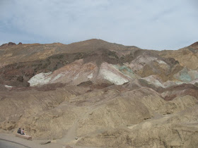
Eventually we made our way back to the truck one careful step after the another. Next we drove up Artist's Drive to Artist's Point. It is a group of multicolored hills and we hiked right into them.

Wild Flowers occasionally added to the colors of the soil.

We climbed around these hills this way and that having a great time exploring. Around every bend and over each ridge the colors of the hills and ground around us changed. We stayed in the valleys of the hills so as not to cause too much erosion. This limited how far we could go and eventually we turned around. Back in the parking lot we had lunch while overlooking the area.

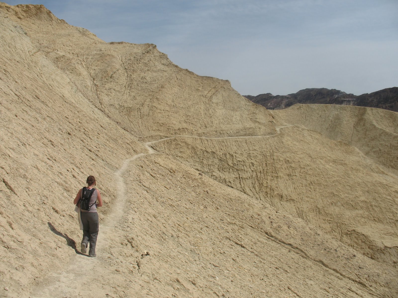
On our way into Death Valley we had past Zabriski Point. There was a lot of cars and people there, so we assumed it must be a great overlook. We decided it would be best for Rachel and I to take the short way there and for Dad to take the long way. The short way being hiking up Golden Canyon and the long way being driving up 190.
Our hike took us up the mouth of Golden Canyon. It's walls were colored like their name and towered over us.

After a mile or so of walking through the canyon the path split. It was clearly marked that the way to Zabriski Point was a switchback up the canyon wall. The area was completely barren. At this point it dawned on me that we had seen hardly any plants all day long. Death Valley is not just a clever name.
Ahead of us was a towering peak. Behind this mammoth rock the clouds rippled on a crisp blue sky.


 Hikes that rise in altitude are a lot of fun because you can look behind you and see where you've been and what you've accomplished.


Soon after we spotted the point the trail appeared to fork. We took the route that looked like the most direct way to the overlook. It wasn't long before we realized we had chosen the wrong path. The one we were on had been created by overzealous sightseers breaking the rules and hiking down from Zabriski Point. The real path lead around the point and ended in the Zabriski parking lot, but at this point we were way up above the real path, so we kept on going. It wasn't long before we hopped over a small wall and were standing on Zabriski Point with all the sightseers. One of them took our picture.

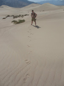
 Dad was waiting for us in the parking lot. We walked dawn the path and met up with him. At this point I had nothing more planned for the day. We had just done quite a bit for one day, but there was still plenty of sunlight left, so we headed up to the Campground nearest to ours, Stovepipe Wells. On the way there we saw an expansive line of sand dunes known as the Mesquite Sand Dunes. We pulled the truck over so we could hike out to them. We hadn't realized it, but we had pulled the truck over on the Devil's Corn Field pull-off.

Devils Corn Field was in between us and the Mesquite Dunes. The "corn field" consists of thousands of Arrow weed plants. The roots of these plants are exposed by the loose sand being blown out from underneath them. The sand blows past these plants and collects in piles known as the Mesquite Sand Dunes. Dad was content to walk as far as the "corn field", but Rachel and I continued on to the dunes.


 We had so much fun on those dunes that we decided we would have to go to more dunes on this trip. We didn't stay for long though because our legs were tired from all the days activities. After playing around for a while we made our way back to Dad's truck. We climbed back into the truck and continued on to take a look at the Stovepipe Wells campground. Immediately after we got back on the road, we saw the real parking lot for the Mesquite Dunes. In our hurry to check out the dunes, we had parked too soon. We were glad we had parked early though because that's the reason we had had the dunes to ourselves and we got to walk through Devil's Corn Field.
Stovepipe Wells Campground is very close to the Mesquite Dunes and soon we were driving though it. We had just come to take a look so we didn't get out of the car. It looked like a nice campground with all the amenities that we had at Furnace Creek, even a pool. After the drive though Stovepipe Campground we turned around and drove back to our campground. As soon as we got home we noticed two roadrunners courting each other.


 The next day we had a much
quicker breakfast than the
previous morning; there were
no bananas slowing down the cooking.
Three planes flew in formation
over our breakfast table.
After we ate we drove back up
towards Stovepipe Wells to
 A bat in the daytime!?!?! How cool is that? Death Valley indeed!
Just south of Stovepipe Wells campground is a mountain in the middle of death valley. Well it's towards the western edge of the valley actually and it is dwarfed by the massive Panamint Mountain Range behind it, but at 6732 ft it is most certainly a mountain within the valley walls. The real name of this solitary peak is Tucki Mountain but we took to calling it middle mountain because that seemed more fitting. We renamed a few things on this trip. The Kit Fox Hills became the Kit Kat hills; I think that happened just because we were hungry.

Mosaic Canyon is on the northern side of Middle Mountain. The geology in Mosaic Canyon is really interesting. Most of the rock is call Noonday Dolomite, but much of the Dolomite was compressed by water pressure when the area was under the Pacific Ocean way back in the day. This compressed Dolomite was transformed into marble and erosion carved narrow paths in the marble and at the same time polished the marble. This process created narrow shoots that we could barely squeeze through.
Dad walked about a mile up the path with us until the canyon opened up and looked like an endless boulder field. He elected to stay in the shade of the beautiful polished marble narrows. Rae and I continued through the open area and soon started to feel the relentless Death Valley sun. After what seemed like forever in the sun the canyon narrowed again and we soon found ourselves navigating a boulder pile. After a couple of tries we found our way though what seemed like a maze of giant rocks. A short time after that a giant wall appeared in front of us. There was a ranger on top of the wall and he called down to ask if we knew the way up. We had our trail guide with us so we called back that we did. According to our book we had to turn back and a path up the canyon wall would be on our left. Sure enough we found a path and were able to continue.
  The path continued above the wall for spell until we reached another wall. This wall looked a little more daunting and there was no ranger on top of this one. We took a look in our guide book and it once again recommended that we turn back and look for a trail up the canyon wall. This trail was harder to spot and when we found it we realized why. We hadn't been looking for a trail that went strait up!

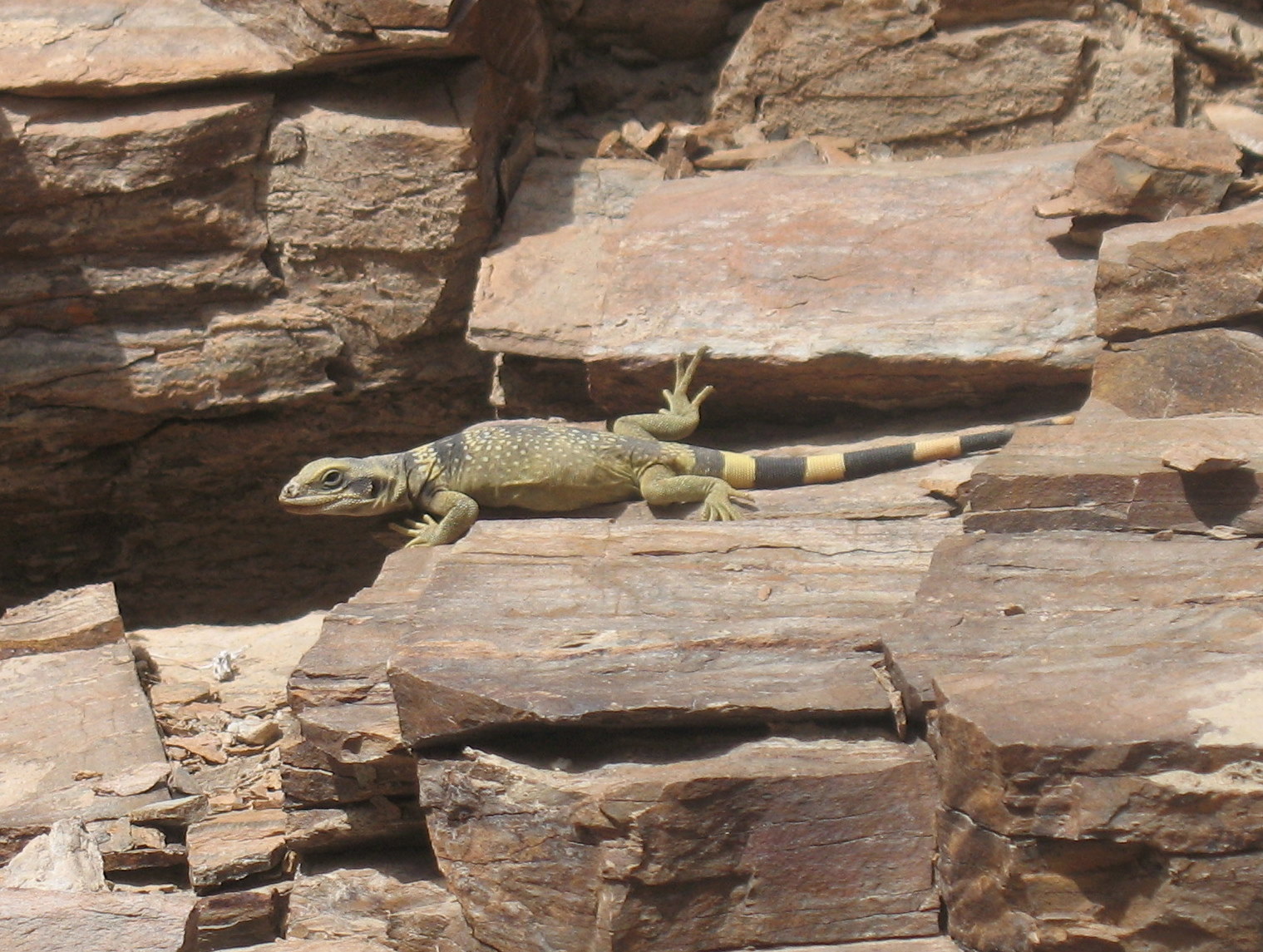
The rocks were dusty and that made climbing a little scary. As we got higher and higher off the canyon floor the thought of turning around faded. Our trail guide said we should be able to meet up with a different trail on top of the ridge to get back to where Dad was and going up seemed easier than trying to get back down. On the way up we saw this cool looking lizard.

Eventually the steep incline we were mounting became more of gentle slop and we were able to look at our surroundings. We had backtracked quite a ways to get up the canyon wall and the cliff that had blocked our path was now pretty far ahead of us.

And behind us we could see all the way to the Floor of Death Valley.

We also saw the path that our trail guide said would take us back via a much shorter route. It was good to know where our way back was. At this time we decided to eat lunch while hiking because we had told Dad we'd be back in an hour and it had already been two hours. According to the guide book we had already made it to where most people never go and we still wanted to find some hidden springs it mentioned. Rachel pulled out our sandwiches and we ate on the go.


After a while we arrived above the cliff that had impeded our hike on the canyon floor.The path went past the cliff and up into another valley. The valley widened for a time and then forked. At this point I had sort of lost track of where we were according to the guide book and the trail had all but disappeared. We knew how to get back to the trail though. We decided to go right at the fork and we hiked up that valley until it's abrupt ending.
 Obviously we turned around and headed back down the valley. When we got to the fork we tried the other way. At this point we were beginning to lose our spirit of exploration. We were starting to think about heading back down the mountain. We said we would do just that after the first ridge. When we reached the first ridge we said we would turn around after the second ridge. At the third ridge we finally did turn back. On our way back we ran into two other hikers. They told us that they had come up the way we were planning to go back. It was reassuring to hear that the path we saw was the path that our guide book had mentioned. We told them we had come up from the canyon floor and told them they might want to avoid that path because it's probably sketchier on the way down and it was pretty sketchy on the way up. They also told us they had seen some bighorn sheep just over the next two ridges. We were pumped. We hadn't seen any sheep yet this trip and that was one of our goals. We thanked them for the info and sped down the alternate path hoping to catch our first glimpse of a bighorn sheep. After what we thought were the first two ridges there were no sheep. After the third ridge there were no sheep. Fourth, no sheep. Fifth, no sheep. Around the six ridge we started to loose hope. Just as we were talking about how disappointing it was to have came so close I spotted something.

Can you see anything? They were pretty far up the hill. That's why it took so long to spot them. I'll zoom in for you.

We were very happy to see this herd. They even had a lamb with them! Very cute. Very cool. We stood around for a while watching, taking pictures and talking about how happy we were to see bighorns. Soon we remembered that Dad was waiting for us and it had been almost three hours. We booked it back. The new path was a strait line down the mountain and getting down took only a fraction of the time it had taken us to get up the canyon. In no time we were back to where we had left Dad. We immediately apologized for being so late and Dad said he thought it had only been an hour. When we told him it had been three he was surprised. Time goes by fast when you're standing in a beautiful canyon watching tourists. We all slipped through the polished canyons together on our way off of middle mountain. Before long we were back to Dad's truck. At this point I had become the unofficial hike planner of our group. I decided that my legs were tired and Rachel and I had taken enough risks for one day. Rae and I had been talking about climbing to the top of Telescope Peak; that is the highest point in the park. I though it would be prudent to take a drive near it and see how much snow was up there before we made mounting the peak an official plan. Everyone agreed that a drive would be a nice change of pace. We took 190 to Emigrant Canyon Road. This took us up and over the western ridge of Death Valley. We got close enough to see that Telescope Peak was really very snowy and we decided we would talk to a ranger before attempting to mount it. After this drive by we headed down (and I do mean down) Wildrose Canyon Road into the Panamint Valley. The Panamint Valley was really quite similar to Death Valley. Sand and salt flats were it's prevailing features. Once in the valley proper we hung a right on Panamint Valley Road and this took us back to 190. From here we proceeded to take 190 all the way back to our home at the Furnace Creek Campground. There was a bike race going on and we saw a woman and a man riding side by side on elliptical bikes. The bikes were very weird looking and awkward and hilarious. Once we got home Rachel and I grabbed our swim suits and headed to the resort next to our campsite. The pool there is fed by water underground and then the pool water is used to water the golf course. Even though Death Valley is one of the driest places on earth there is still water underground. One great side effect of this water recycling is that the pool water isn't chlorinated. Swimming felt great and after we swam we showered. A shower is a real luxury when you're camping and we needed it. After all that pampering we made it back home in time to watch a beautiful sunset at our campsite.

The Next morning we decided we were going to drive to the Northern most section of the park and explore the Eureka Dunes. We got very far north and when the pavement ended on the main road and we realized that even though we had a full tank of gas when we left we weren't going to make it there and back. That is how big Death Valley is. Some people drive around with gas cans on their cars. We were near the Scotty's Castle gas station, but a sign said they were all out of gas. We decided not to let all that driving go to waist. We were going to Ubehebe Crater. It was up near Scotty's Castle. We had seen signs saying it was closed for construction, but we were so close we figured we should check it out. We found out that the entrance was barricaded.

Dad stopped the truck and assessed the road block. He had purchased his first senor pass upon entering the park and we figured it entitled him to certain liberties within the boundaries of the park. One of those liberties as we saw it was ignoring that road block.

After all it was a Sunday and no one was working on the road. we figured if the road became unnavigable we could always turn around. As it turned out there was just minor construction going on in the parking lot. The crater was amazing. It was formed by a volcanic explosion some time in the last 1000 years. It was pretty much just what you'd think a volcanic crater would look like.

It was incredibly windy up on the lip of the crater and we didn't hang around long. We all hopped back in the truck, drove back through the barricade and sped off to check out Scotty's Castle. On route we passed a ranger headed towards the crater. We figured we had left just in time.
Scotty's Castle was just that; a castle.

There was an option to take a tour inside but we opted not to. We figured there was too much outdoors to explore in Death Valley. Instead we talked to a ranger in the ranger station. There was American Reinvestment and Recovery Act construction on the road through the park we had just come up on. We asked the Ranger if it would be faster for us to drive out and around the park to get back south. He told us that not only would in not be any faster, but there was a speed trap in one of the towns along the way. We took his advice and drove back the way we had come. On the dirt road we drove right through a dust devil.

The picture doesn't do it much justice, but it was pretty cool it shook the truck a little.

Since we were unable to get to the Eureka Dunes I thought we should go to the Mesquite Flat Dunes again. The day before we had only explored a small section of the dune field. Dad dropped us off at the historic Stovepipe Wells and our plan was to walk strait across the dune field to the Dune parking lot where Dad would meet us. There was no trail, but we knew where the highest dune was in relationship to the parking lot so we had a reference point on the horizon to walk towards. It looked like the whole walk would be about 4 or 5 miles.

We said goodbye to Dad
And headed off toward the big dunes way off in the distance.

To late to turn back now, there goes Dad!

Our surroundings were just like what I always think of as a classic desert. The kind of desert you might see in an overplayed Hollywood scene where the hero falls to his or her knees in the drifting sand and almost dies of exposure. Good thing we knew where we were and where we were going! There were lizard tracks everywhere in the loose sand.


Sometimes the sand was loose
and at other times it was
hardened and cracked
from the relentless
Death Valley sun.

And sometimes
there were patches
of hardened sand
that looked like
the old forgotten
foundations of
ill-fated
buildings.
Eventually even the small amount of vegetation that had been around us gave way to a barren waistband of drifting sand.

We hiked on.

We started to get very hot so we took our shoes off.
Each heavy step took us gradually closer to the big dune.

We hiked up one dune after another always running down the other side. Eventually we made it to the big dune. At this point we knew exactly where the parking lot where we planned to meet Dad was. We didn't need to climb the big dune to find it. We needed to climb the dune for other reasons; fun reasons.

Getting to the top felt great. We felt much more accomplished than if we had just hiked up the big dune from the parking lot. We had come from far off in the distance. We made it!

Once at the top we took in the amazing view. Then we took turns running full speed down the dune. I must have made it to 25 miles per hour. When we got to the bottom there was no breeze down there to cool the sand and it was piping hot. We put our shoes back on as quick as we could. Our feet were only slightly cooked. At this point we were less than a mile from the parking lot. Soon we made it and Dad was waiting for us.

We all piled in the truck and headed off to Keane Wonder Mill and Mine. It was near by and looked interesting. When we got there it was closed due to toxic gases escaping the mine. I had made my second mistake as event planner that day. Luckily we were very close the the Salt Creek Interpretive trail. Dad turned the truck around and we sped off to Salt Creek.
Once we got there a passing tourist bumped into Dad and said somethings that I wont repeat on this blog. Dad got angry and started to transform into a muscle bound freak of nature controlled solely by his rage.

Actually that didn't happen. Nobody bumped into Dad. It was just windy; very very windy. The Salt Creek was just what it sounds like, a creek full of salt water.
Whats very strange about it is there are fish in the incredibly salty water.
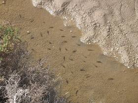
These little guys are called pupfish and they live in extreme conditions.
After we walked the short boardwalk at Salt Creek we headed off the 20 Mule Team Canyon. It was a historic canyon and we a ll agreed that it was thoroughly boring.
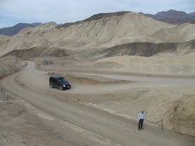
It was just a dirt road that when through what looked like the inside of a quarry. Actually the area had once been mind by the Borax Company so in fact it was the inside of a quarry. We had seen so many wonderful sites that this lame one gave us a good excuse to moan and groan and talk about what a crappy place 20 Mule Team Canyon is. Sometimes it's fun to complain a little and we did plenty of complaining about stupid 20 Mule Team Canyon.
The next morning we ate banana pancakes. They were delicious, but the bananas made them take forever to cook and we only had one pan. We took turns eating one pancake at a time. Breakfast took about an hour and a half.

There was a Great-tailed Grackle and a Eurasian Collared Dove at the campsite next to ours. They were watching and waiting for us to finish up our meal in the hopes of getting some scraps.

In the air we saw a different sort of bird. A stealth bomber and another plane were overhead either training or doing a photo shoot.

Having that much time in between pancakes afforded me many opportunities to look over my new map and trail guide to figure out just what we were going to do in this incredibly vast park. I thought heading south for our first excursion seem like a fine idea so that's what we did. As soon as our lengthy breakfast was finished we piled in Dad's truck and drove to Badwater Basin, the lowest spot in the US.
Badwater has a small spring fed pool of salty water next to an expansive salt plain. The salt plain is a crust of salt which crystallizes to form hexagonal shapes. A huge path of crushed salt crystals leads from the road to the middle of the salt plain. Somewhere in this giant salt slick is the lowest spot in the U.S. at 280 feet below sea level. The crushed salt was caused by the millions of tourists walking out into the salt field.

On the mountain wall with a clear view from the parking lot is a sign showing where sea level is.


We made our way down the path of crush salt crystals just like everyone else. The sun on the white sand was blinding. I was really missing the 1% on my 99% UV blocking sunglasses. The path of crushed crystals slowly got wider and wider. This widening was caused by people exploring the salty expanse. Considering the salt goes on for miles in all directions the crushed crystals in this tiny fraction of the area weren't really that disturbing.
From a distance it looks a lot like snow

Close up it is obviously salt.


 After Badwater Basin we headed to Natural Bridge Trail. The trail head is just above the basin, but don't be fooled by the picture on the right. That is just a thin finger of salt. The main part of Badwater Basin is just south (left) of this picture. The Natural Bridge Trail goes right up the mouth of a canyon. This canyon was shaped by powerful flash floods. The walls towered over us on either side. The path to the natural bridge was not a long one. In less than half a mile we were staring up at the bridge.
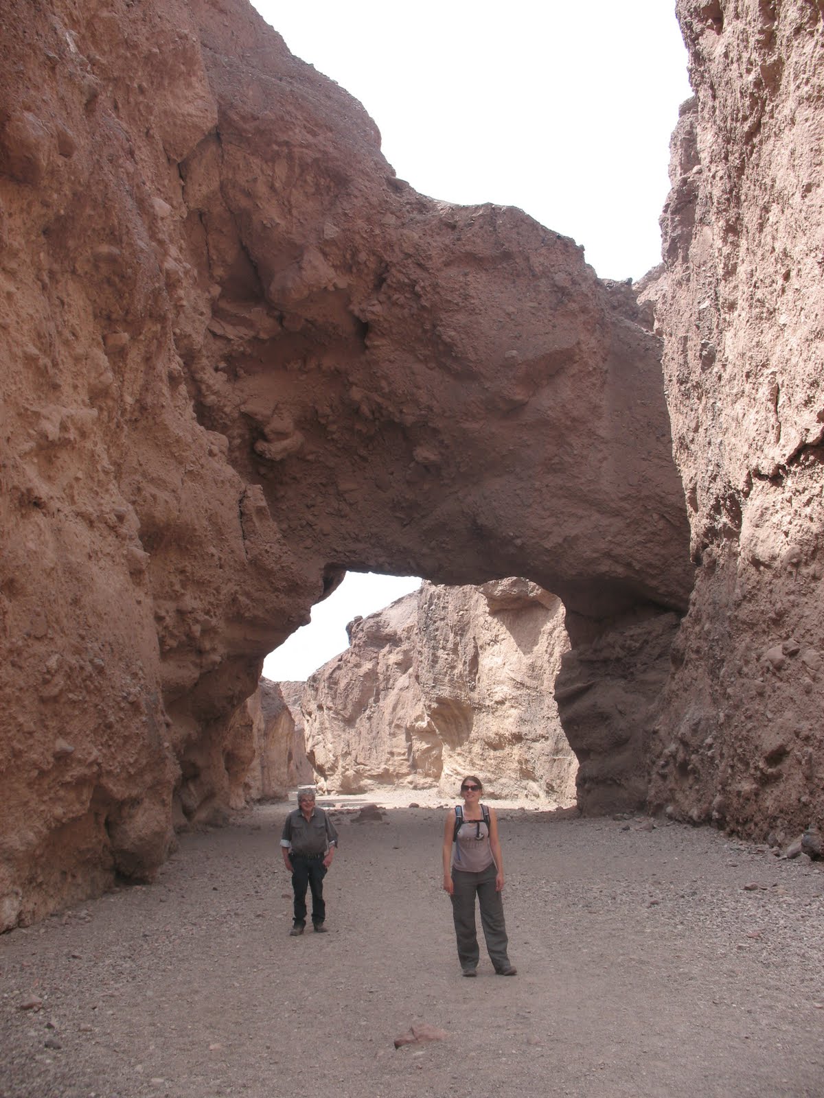
A little further up the trail was a massive dry waterfall.

 There was a big ledge in the shade here that made a great natural bench. Dad had a seat and told Rachel and I to continued up the path without him. Soon we came across another dry wash. This time we would have to climb it to keep going. It was an easy scramble, but after this point we were alone. Spots like these are are great people filters. Most hikers don't like to get on their hands and knees. Just above the climb there was a giant bolder wedged between the canyon walls. It was probably thousands of years ago, but at one time this boulder was dislodged from it's original resting place and tumbled down the canyon. It was easy to imagine Indiana Jones running for his life with this giant rock giving chase.
Soon after we squeezed under the boulder there was another dry wash. This time it was not climbable with out ropes. We don't climb with ropes, so we turned around.
We met up with Dad where we had left him and we all walked back to the truck.
We drove back to the valley floor and north to Devil's Golf Course.
Devil's Golf course, like Badwater Basin, is a salt plain, but it's formations are much bigger than the small crystals at Badwater Basin.

There was a tourist in the parking lot who had taken on the job of tour guide. He pointed at some people out on the golf course and told us they were looking at a spot that had been blasted with TNT to see what was underneath the strange formations. Following this enthusiastic park visitors advice, we made our way over there by carefully navigating the rugged terrain.

 We arrived where people were milling about and sure enough there was a hole in the crust. It was pretty cool. There was water under the crust with even more salt crystals underneath it. We hung out there for a while studying the hole. The landscape on Devils Golf Course is amazing. It is like no other place I have ever seen.
Eventually we made our way back to the truck one careful step after the another. Next we drove up Artist's Drive to Artist's Point. It is a group of multicolored hills and we hiked right into them.

Wild Flowers occasionally added to the colors of the soil.

We climbed around these hills this way and that having a great time exploring. Around every bend and over each ridge the colors of the hills and ground around us changed. We stayed in the valleys of the hills so as not to cause too much erosion. This limited how far we could go and eventually we turned around. Back in the parking lot we had lunch while overlooking the area.
Notice Rachel and Dad in the bottom left corner.


On our way into Death Valley we had past Zabriski Point. There was a lot of cars and people there, so we assumed it must be a great overlook. We decided it would be best for Rachel and I to take the short way there and for Dad to take the long way. The short way being hiking up Golden Canyon and the long way being driving up 190.
Our hike took us up the mouth of Golden Canyon. It's walls were colored like their name and towered over us.

After a mile or so of walking through the canyon the path split. It was clearly marked that the way to Zabriski Point was a switchback up the canyon wall. The area was completely barren. At this point it dawned on me that we had seen hardly any plants all day long. Death Valley is not just a clever name.
Ahead of us was a towering peak. Behind this mammoth rock the clouds rippled on a crisp blue sky.

Soon the path got very narrow.
We had to stop an take a picture of what was behind us!
 Hikes that rise in altitude are a lot of fun because you can look behind you and see where you've been and what you've accomplished.
Over the next ridge we caught our first glimpse of Zabriski Point.

Soon after we spotted the point the trail appeared to fork. We took the route that looked like the most direct way to the overlook. It wasn't long before we realized we had chosen the wrong path. The one we were on had been created by overzealous sightseers breaking the rules and hiking down from Zabriski Point. The real path lead around the point and ended in the Zabriski parking lot, but at this point we were way up above the real path, so we kept on going. It wasn't long before we hopped over a small wall and were standing on Zabriski Point with all the sightseers. One of them took our picture.

 Dad was waiting for us in the parking lot. We walked dawn the path and met up with him. At this point I had nothing more planned for the day. We had just done quite a bit for one day, but there was still plenty of sunlight left, so we headed up to the Campground nearest to ours, Stovepipe Wells. On the way there we saw an expansive line of sand dunes known as the Mesquite Sand Dunes. We pulled the truck over so we could hike out to them. We hadn't realized it, but we had pulled the truck over on the Devil's Corn Field pull-off.
Devils Corn Field was in between us and the Mesquite Dunes. The "corn field" consists of thousands of Arrow weed plants. The roots of these plants are exposed by the loose sand being blown out from underneath them. The sand blows past these plants and collects in piles known as the Mesquite Sand Dunes. Dad was content to walk as far as the "corn field", but Rachel and I continued on to the dunes.

There was no one around us; we had the dunes to ourselves. Rachel was really excited to run on and around the dunes.
This is my favorite picture of Rachel, ever.

 We had so much fun on those dunes that we decided we would have to go to more dunes on this trip. We didn't stay for long though because our legs were tired from all the days activities. After playing around for a while we made our way back to Dad's truck. We climbed back into the truck and continued on to take a look at the Stovepipe Wells campground. Immediately after we got back on the road, we saw the real parking lot for the Mesquite Dunes. In our hurry to check out the dunes, we had parked too soon. We were glad we had parked early though because that's the reason we had had the dunes to ourselves and we got to walk through Devil's Corn Field.
Stovepipe Wells Campground is very close to the Mesquite Dunes and soon we were driving though it. We had just come to take a look so we didn't get out of the car. It looked like a nice campground with all the amenities that we had at Furnace Creek, even a pool. After the drive though Stovepipe Campground we turned around and drove back to our campground. As soon as we got home we noticed two roadrunners courting each other.

Things got heavy quick between these two.
Meep Meep...
Meep Meep...

We slept well that night after all we had done that day.
 The next day we had a much
quicker breakfast than the
previous morning; there were
no bananas slowing down the cooking.
Three planes flew in formation
over our breakfast table.
After we ate we drove back up
towards Stovepipe Wells to
Mosaic Canyon. As soon as we
Got out of the car I snapped another aerial photo.
Got out of the car I snapped another aerial photo.
 A bat in the daytime!?!?! How cool is that? Death Valley indeed!
Just south of Stovepipe Wells campground is a mountain in the middle of death valley. Well it's towards the western edge of the valley actually and it is dwarfed by the massive Panamint Mountain Range behind it, but at 6732 ft it is most certainly a mountain within the valley walls. The real name of this solitary peak is Tucki Mountain but we took to calling it middle mountain because that seemed more fitting. We renamed a few things on this trip. The Kit Fox Hills became the Kit Kat hills; I think that happened just because we were hungry.

Mosaic Canyon is on the northern side of Middle Mountain. The geology in Mosaic Canyon is really interesting. Most of the rock is call Noonday Dolomite, but much of the Dolomite was compressed by water pressure when the area was under the Pacific Ocean way back in the day. This compressed Dolomite was transformed into marble and erosion carved narrow paths in the marble and at the same time polished the marble. This process created narrow shoots that we could barely squeeze through.
Dad walked about a mile up the path with us until the canyon opened up and looked like an endless boulder field. He elected to stay in the shade of the beautiful polished marble narrows. Rae and I continued through the open area and soon started to feel the relentless Death Valley sun.
 After what seemed like forever in the sun the canyon narrowed again and we soon found ourselves navigating a boulder pile. After a couple of tries we found our way though what seemed like a maze of giant rocks. A short time after that a giant wall appeared in front of us. There was a ranger on top of the wall and he called down to ask if we knew the way up. We had our trail guide with us so we called back that we did. According to our book we had to turn back and a path up the canyon wall would be on our left. Sure enough we found a path and were able to continue.
  The path continued above the wall for spell until we reached another wall. This wall looked a little more daunting and there was no ranger on top of this one. We took a look in our guide book and it once again recommended that we turn back and look for a trail up the canyon wall. This trail was harder to spot and when we found it we realized why. We hadn't been looking for a trail that went strait up!
The rocks were dusty and that made climbing a little scary. As we got higher and higher off the canyon floor the thought of turning around faded. Our trail guide said we should be able to meet up with a different trail on top of the ridge to get back to where Dad was and going up seemed easier than trying to get back down. On the way up we saw this cool looking lizard.
Eventually the steep incline we were mounting became more of gentle slop and we were able to look at our surroundings. We had backtracked quite a ways to get up the canyon wall and the cliff that had blocked our path was now pretty far ahead of us.
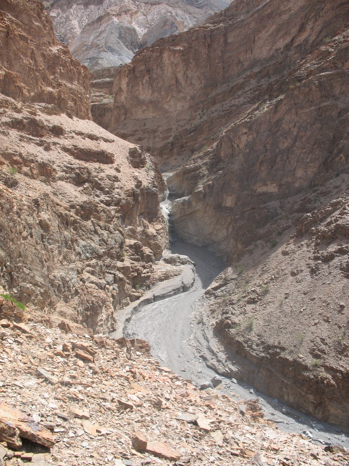
And behind us we could see all the way to the Floor of Death Valley.

We also saw the path that our trail guide said would take us back via a much shorter route. It was good to know where our way back was. At this time we decided to eat lunch while hiking because we had told Dad we'd be back in an hour and it had already been two hours. According to the guide book we had already made it to where most people never go and we still wanted to find some hidden springs it mentioned. Rachel pulled out our sandwiches and we ate on the go.


 Obviously we turned around and headed back down the valley. When we got to the fork we tried the other way. At this point we were beginning to lose our spirit of exploration. We were starting to think about heading back down the mountain. We said we would do just that after the first ridge. When we reached the first ridge we said we would turn around after the second ridge. At the third ridge we finally did turn back. On our way back we ran into two other hikers. They told us that they had come up the way we were planning to go back. It was reassuring to hear that the path we saw was the path that our guide book had mentioned. We told them we had come up from the canyon floor and told them they might want to avoid that path because it's probably sketchier on the way down and it was pretty sketchy on the way up. They also told us they had seen some bighorn sheep just over the next two ridges. We were pumped. We hadn't seen any sheep yet this trip and that was one of our goals. We thanked them for the info and sped down the alternate path hoping to catch our first glimpse of a bighorn sheep. After what we thought were the first two ridges there were no sheep. After the third ridge there were no sheep. Fourth, no sheep. Fifth, no sheep. Around the six ridge we started to loose hope. Just as we were talking about how disappointing it was to have came so close I spotted something.
Can you see anything? They were pretty far up the hill. That's why it took so long to spot them. I'll zoom in for you.

BAM!
We were very happy to see this herd. They even had a lamb with them! Very cute. Very cool. We stood around for a while watching, taking pictures and talking about how happy we were to see bighorns. Soon we remembered that Dad was waiting for us and it had been almost three hours. We booked it back. The new path was a strait line down the mountain and getting down took only a fraction of the time it had taken us to get up the canyon.
 In no time we were back to where we had left Dad. We immediately apologized for being so late and Dad said he thought it had only been an hour. When we told him it had been three he was surprised. Time goes by fast when you're standing in a beautiful canyon watching tourists. We all slipped through the polished canyons together on our way off of middle mountain. Before long we were back to Dad's truck. At this point I had become the unofficial hike planner of our group. I decided that my legs were tired and Rachel and I had taken enough risks for one day. Rae and I had been talking about climbing to the top of Telescope Peak; that is the highest point in the park. I though it would be prudent to take a drive near it and see how much snow was up there before we made mounting the peak an official plan. Everyone agreed that a drive would be a nice change of pace. We took 190 to Emigrant Canyon Road. This took us up and over the western ridge of Death Valley. We got close enough to see that Telescope Peak was really very snowy and we decided we would talk to a ranger before attempting to mount it. After this drive by we headed down (and I do mean down) Wildrose Canyon Road into the Panamint Valley. The Panamint Valley was really quite similar to Death Valley. Sand and salt flats were it's prevailing features. Once in the valley proper we hung a right on Panamint Valley Road and this took us back to 190. From here we proceeded to take 190 all the way back to our home at the Furnace Creek Campground. There was a bike race going on and we saw a woman and a man riding side by side on elliptical bikes. The bikes were very weird looking and awkward and hilarious. Once we got home Rachel and I grabbed our swim suits and headed to the resort next to our campsite. The pool there is fed by water underground and then the pool water is used to water the golf course. Even though Death Valley is one of the driest places on earth there is still water underground. One great side effect of this water recycling is that the pool water isn't chlorinated. Swimming felt great and after we swam we showered. A shower is a real luxury when you're camping and we needed it. After all that pampering we made it back home in time to watch a beautiful sunset at our campsite.
The Next morning we decided we were going to drive to the Northern most section of the park and explore the Eureka Dunes. We got very far north and when the pavement ended on the main road and we realized that even though we had a full tank of gas when we left we weren't going to make it there and back. That is how big Death Valley is. Some people drive around with gas cans on their cars. We were near the Scotty's Castle gas station, but a sign said they were all out of gas. We decided not to let all that driving go to waist. We were going to Ubehebe Crater. It was up near Scotty's Castle. We had seen signs saying it was closed for construction, but we were so close we figured we should check it out. We found out that the entrance was barricaded.

Dad stopped the truck and assessed the road block. He had purchased his first senor pass upon entering the park and we figured it entitled him to certain liberties within the boundaries of the park. One of those liberties as we saw it was ignoring that road block.

After all it was a Sunday and no one was working on the road. we figured if the road became unnavigable we could always turn around. As it turned out there was just minor construction going on in the parking lot. The crater was amazing. It was formed by a volcanic explosion some time in the last 1000 years. It was pretty much just what you'd think a volcanic crater would look like.

It was incredibly windy up on the lip of the crater and we didn't hang around long. We all hopped back in the truck, drove back through the barricade and sped off to check out Scotty's Castle. On route we passed a ranger headed towards the crater. We figured we had left just in time.
Scotty's Castle was just that; a castle.

There was an option to take a tour inside but we opted not to. We figured there was too much outdoors to explore in Death Valley. Instead we talked to a ranger in the ranger station. There was American Reinvestment and Recovery Act construction on the road through the park we had just come up on. We asked the Ranger if it would be faster for us to drive out and around the park to get back south. He told us that not only would in not be any faster, but there was a speed trap in one of the towns along the way. We took his advice and drove back the way we had come. On the dirt road we drove right through a dust devil.

The picture doesn't do it much justice, but it was pretty cool it shook the truck a little.

Since we were unable to get to the Eureka Dunes I thought we should go to the Mesquite Flat Dunes again. The day before we had only explored a small section of the dune field. Dad dropped us off at the historic Stovepipe Wells and our plan was to walk strait across the dune field to the Dune parking lot where Dad would meet us. There was no trail, but we knew where the highest dune was in relationship to the parking lot so we had a reference point on the horizon to walk towards. It looked like the whole walk would be about 4 or 5 miles.

We said goodbye to Dad

And headed off toward the big dunes way off in the distance.

To late to turn back now, there goes Dad!

Our surroundings were just like what I always think of as a classic desert. The kind of desert you might see in an overplayed Hollywood scene where the hero falls to his or her knees in the drifting sand and almost dies of exposure. Good thing we knew where we were and where we were going! There were lizard tracks everywhere in the loose sand.


Sometimes the sand was loose
and at other times it was
hardened and cracked
from the relentless
Death Valley sun.

And sometimes
there were patches
of hardened sand
that looked like
the old forgotten
foundations of
ill-fated
buildings.
Eventually even the small amount of vegetation that had been around us gave way to a barren waistband of drifting sand.

We hiked on.

We started to get very hot so we took our shoes off.

Each heavy step took us gradually closer to the big dune.

We hiked up one dune after another always running down the other side. Eventually we made it to the big dune. At this point we knew exactly where the parking lot where we planned to meet Dad was. We didn't need to climb the big dune to find it. We needed to climb the dune for other reasons; fun reasons.

Getting to the top felt great. We felt much more accomplished than if we had just hiked up the big dune from the parking lot. We had come from far off in the distance. We made it!

Once at the top we took in the amazing view. Then we took turns running full speed down the dune. I must have made it to 25 miles per hour. When we got to the bottom there was no breeze down there to cool the sand and it was piping hot. We put our shoes back on as quick as we could. Our feet were only slightly cooked. At this point we were less than a mile from the parking lot. Soon we made it and Dad was waiting for us.

We all piled in the truck and headed off to Keane Wonder Mill and Mine. It was near by and looked interesting. When we got there it was closed due to toxic gases escaping the mine. I had made my second mistake as event planner that day. Luckily we were very close the the Salt Creek Interpretive trail. Dad turned the truck around and we sped off to Salt Creek.
Once we got there a passing tourist bumped into Dad and said somethings that I wont repeat on this blog. Dad got angry and started to transform into a muscle bound freak of nature controlled solely by his rage.

Actually that didn't happen. Nobody bumped into Dad. It was just windy; very very windy. The Salt Creek was just what it sounds like, a creek full of salt water.
Whats very strange about it is there are fish in the incredibly salty water.

These little guys are called pupfish and they live in extreme conditions.
After we walked the short boardwalk at Salt Creek we headed off the 20 Mule Team Canyon. It was a historic canyon and we a ll agreed that it was thoroughly boring.

It was just a dirt road that when through what looked like the inside of a quarry. Actually the area had once been mind by the Borax Company so in fact it was the inside of a quarry. We had seen so many wonderful sites that this lame one gave us a good excuse to moan and groan and talk about what a crappy place 20 Mule Team Canyon is. Sometimes it's fun to complain a little and we did plenty of complaining about stupid 20 Mule Team Canyon.
This is where I began to write this blog again a year later.
In the notebook I kept during the trip I wrote this about 20 Mule Team Canyon.
"Drove through 20 Mule Team Canyon... mud... sucked."
After that we felt like we needed to see something incredible. I had heard that Dante's View was one of the most popular spots in the park so we headed up that way. It was quite the drive to get there. The road is so steep there is a turn around spot for RV's because they couldn't possibly make it up the steep grade. Dante's View is an overlook and man what an overlook it is. It's hard to describe with out the picture so check this out.
We were 5,475 ft high overlooking an incredibly steep slope that seemed to go strait down to the floor of Death Valley almost 6,000 ft below. We could have stayed all night long if it hadn't been for the wind. It was cold and strong and had been picking up all day. With all we had done that day we were exhausted so we decided we should go back to camp. We were hoping that the wind would die down as we got lower in elevation, but it didn't. By the time we got back to camp I'm pretty sure we were in a bona fide wind storm.

And the tent was being blow around

We were 5,475 ft high overlooking an incredibly steep slope that seemed to go strait down to the floor of Death Valley almost 6,000 ft below. We could have stayed all night long if it hadn't been for the wind. It was cold and strong and had been picking up all day. With all we had done that day we were exhausted so we decided we should go back to camp. We were hoping that the wind would die down as we got lower in elevation, but it didn't. By the time we got back to camp I'm pretty sure we were in a bona fide wind storm.
There were crazy circular clouds in the sky.

And the tent was being blow around

It wouldn't have been that bad but sand was blowing everywhere and it was very irritating on the eyes.
Since we were living outdoors there wasn't much we could do, so we just hung out. This was the only night we couldn't have a fire. I suppose it would have been possible but we didn't even try to light one. We had a good time though just hanging out and talking.
That night just like every other night at Death Valley Dad slept in his Ford Transit and Rachel and I when to bed in our tent. At about 3 in the morning Rachel and I left the tent for the shelter of our rental car. The sand was too much for us. It blew right through the walls of our tent and into our eyes and mouths. That was not a pleasant evening. We got a little shut eye in the car, but not much. In the morning Dad told us he hadn't been able to fall asleep until he heard us get into the car because he had been worried about us. It was really quite a storm.
The next morning I wrote this in my notebook.
"Sand everywhere. Still windy. Forecast says wind though tonight. Sitting in car."
We were pretty miserable, but we weren't about to let a little sand and wind keep us from exploring the park. We decided to drive to Darwin Fall on the west side of the park. On the way there we passed the Stovepipe Wells campground and we realized we could have had it a lot worsee. We could have been camping near the dunes.
I took these pictures of Stovepipe Wells as we sped past.

 They got it a lot worst than we did. The day before there had been a whole bunch of tents in this campground. All tent campers at Stovepipe Wells had packed up and left. Or possibly their tents had blown away!
After a drive we got out of
the car for the short hike up to Darwin
Falls. There was almost no wind
in the shelter of the hills. We
were very thankful for the break.

This large irrigation
pipe that lead up the
beginning of the path
was the first sign of fresh
water we had seen since
we had arrived in the park
Father up the trial there was a large boulder on a precarious perch.
 After a short trail and a few hops over a creek we were at the falls.
The waterfall was amazing. The lush area that surrounded it was is was a pleasant contrast to the desert landscape we had been exploring all week. Bird songs and the sound of rushing water filled the air. I had read in my hiking book that there were more falls above the waterfall so Rachel and I busied ourselves with trying to find the best way up the rock walls.
We found a place to scramble up just to the left of the waterfall. Dad stayed down by the main fall and told us to be careful.
We found a nice spot to sit above the main fall.

Just above the main fall we found another.

We kept climbling

And found another fall.

Next we climbed over that boulder next to Rachel and above that fall was.......
You guest it, another fall!
 This fall was really awesome, it was really high and felt like our secret because we had climbs so much to get to it. Rachel snapped this picture of me to show how high the fall is.
 The weather was perfect and we seriously considered swimming, but our guidebook said that this was a fragile water source and not to swim. We decided that we wouldn't, with all the wind back home we though it might not be a good idea to get wet anyway. So we headed back down and when we found Dad again we also found a coot swimming in the lowest pool.
Darwin Falls ended up being a great place to go. You don't normally think about waterfalls when you think about Death Valley, but it has a four tiered fall!
We then walked the short walk back to Dad's truck and headed just a little ways north to Father Crowley Point. This is an overlook with a great view of the Panamint Valley
and Telescope peak. It was cool to look at the park from a western vantage point.

After this we were all really tired. We hadn't slept well the night before on account of the wind storm. We decided to head back to camp and have a fire and early bedtime.
When we got back to wind had died down, it was great. We hadn't spent a lot of time just chilling at camp and it was great to just sit and talk without wind for once.
In the morning Dad packed up his gear and left. He was off to Los Banos CA to visat with his great aunt Eileen. We said goodbye and he drove off.

I cant say enough how thankful I am that Dad, Rachel and I got to spent this time together. We all had such a good time. It warms my heart toremember how much Rachel and Dad joked around with one another. It meant a lot to me that Dad would drive all the way to stay with us in the desert. I miss him, but I have a lot of great memories.
After Dad left Death Valley Rachel and I had decided that we had done enough hiking. We drove up to the Stovepipe Wells Campground and spent the whole day at the pool.
That's right, our last day in Death Vally was spent poolside and we deserved it.

We spent on more night camping in the vast flat bass of Death valley and the next morning, at sunrise, we drove off to camp on the beach in San Diego.

Our 13 day trip was coming to a close. The great thing about really long vacations is that when they are over you are ready to go home. That's why if it were up to me, every trip would be longer than a week. Of course now days we are so busy we will take what we can get.
No comments:
Post a Comment